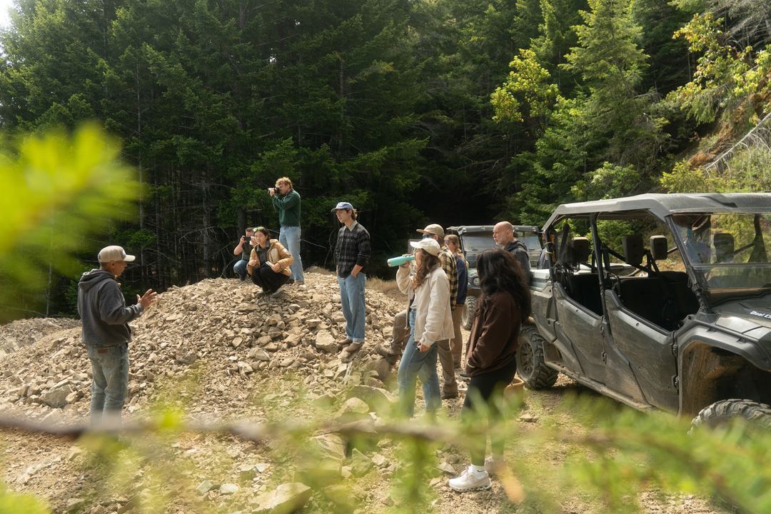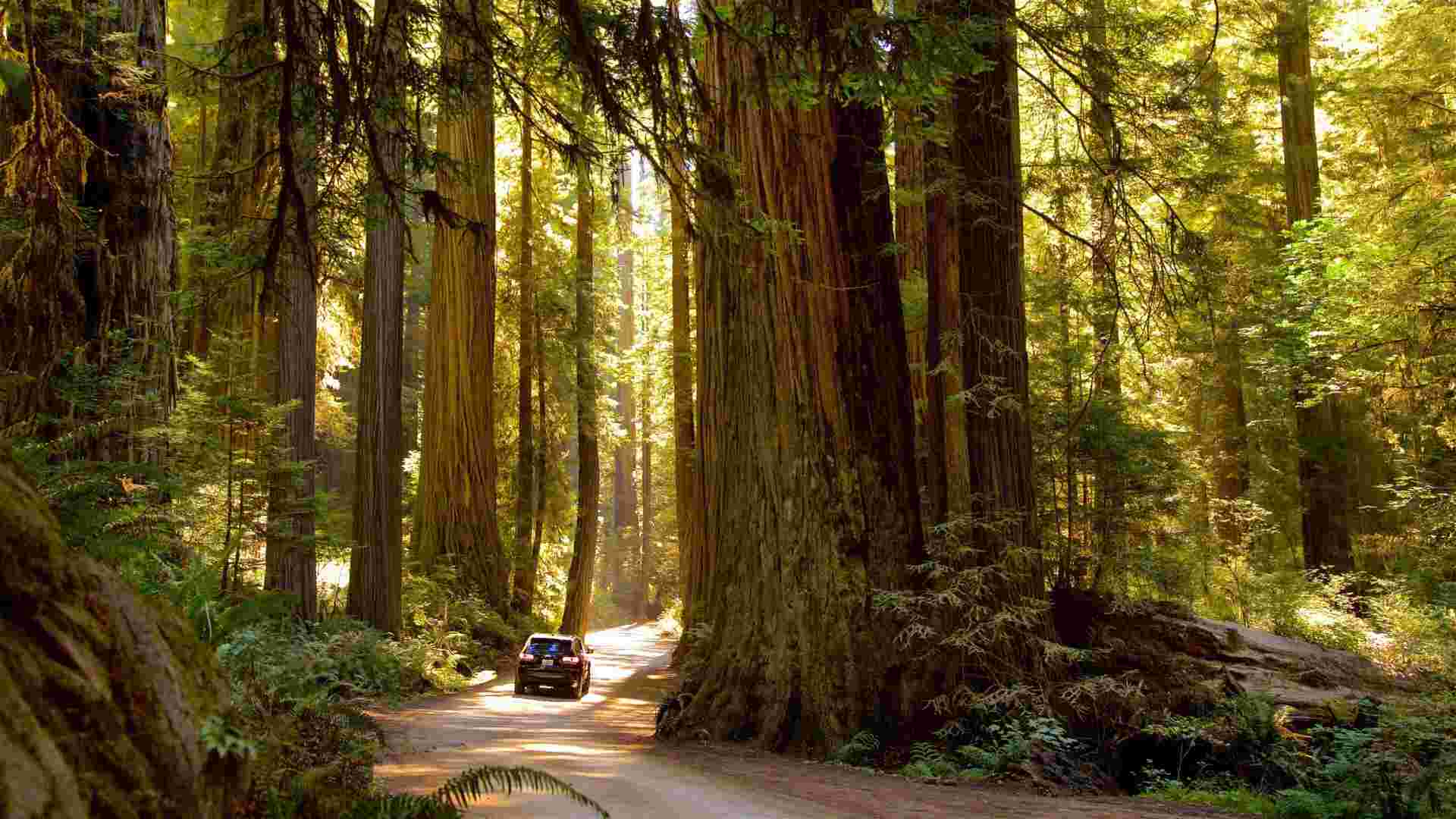
At Usal Redwood Forest on the Mendocino Coast, we manage 50,000 acres of coast redwood. That is 77 Central Parks worth of forest, holding 35 million trees, 4.8 million metric tons of CO₂e sequestered over the last decade, and nearly 20 miles of restored salmon-bearing streams. Alongside the fieldwork that has always driven this place, we have been building a network of sensors, cameras, acoustic monitors, and aerial tools that reads the forest continuously and feeds what it finds back to the people making decisions on the ground. We call it the Smart Forest. This is the vision behind it and what the technology actually does out there in the trees.
Real-time intelligence across the largest redwood landscape on Earth
A forest the size of Usal is always changing. Water temperatures in a creek shift across the season. A species absent for years reappears in a restored section of forest. A stressed hillside starts showing signs of recovery. These things happen constantly and often between field visits, which means without a monitoring system running all the time, a lot of what the forest is telling us goes unread.
The Smart Forest is the monitoring and communications infrastructure for the full 50,000-acre property. The goal is straightforward: measure what is happening across the landscape continuously, verify whether restoration work is producing the right ecological outcomes, and make better decisions about where to focus resources. The vision is not a forest run by technology. It is a forest understood well enough that the people caring for it can act with precision instead of guesswork.

The numbers behind one of California's great conservation stories
The forest holds an estimated 4.8 million metric tons of CO₂e sequestered over the last decade. Over 35 million trees are standing and growing. We have planted more than 250,000 native redwoods since restoration began, restored nearly 20 miles of salmon-bearing streams, and kept 162,390 cubic yards of sediment out of rivers through road decommissioning and bank stabilization work.
Those figures represent more than a decade of on-the-ground effort. The Smart Forest is what makes it possible to track whether that effort is producing the outcomes we are working toward, rigorously enough to share with partners, funders, and the scientific community. When we say the forest is recovering, the data behind that claim matters.
There is also a practical reason that goes beyond reporting. Restoration decisions on a landscape this large come constantly: where to plant, which creek sections need attention, where fire risk is building. The sensor data makes those decisions sharper. That is the core of what this system is built to do.

Cameras, acoustics, sensors, drones. The full picture, continuously
The monitoring system at Usal is built around three connected layers.
Forest sensors on the ground include 23 AI-enabled wildlife cameras logging species presence and movement in near real time, Song Meter bioacoustic recorders capturing the full soundscape of the ecosystem continuously, ultrasonic bat detectors, thermal imaging, and soil sensors. The bioacoustic monitors deserve a closer look. Every species contributes its own acoustic signature: songbirds layering through the canopy at dawn, ancient redwood trunks creaking in coastal wind, northern spotted owl calls logged before sunrise, water moving through the creek bed in rhythms that shift with every rainfall. The software identifies each species by acoustic fingerprint, by pattern and frequency, automatically. At Usal, this monitoring has already detected the northern spotted owl, a federally threatened species, across multiple sections of the property.
Water and watershed sensors track the physical conditions that determine whether salmon restoration is working. Stream water quality instruments, soil moisture probes, and groundwater tools monitor the Usal watershed continuously. Juvenile coho salmon cannot survive water temperatures above certain thresholds, and knowing in near real time which creek sections run warmest in summer tells us exactly where riparian replanting will make the most difference.
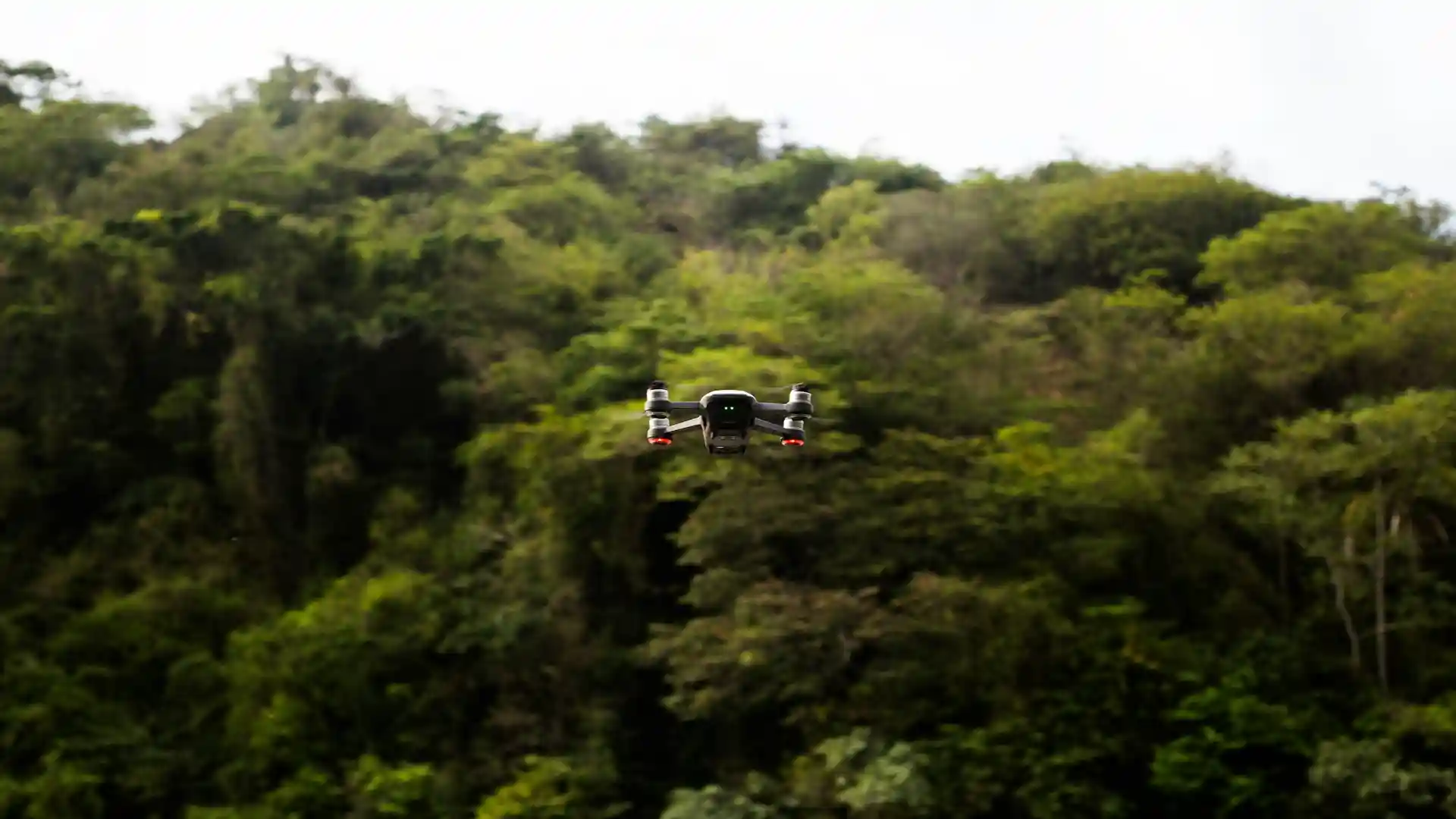
Drone and GIS mapping provides the aerial view that ties everything together. Regular flights let us track canopy density, identify where the forest is recovering or still under stress, and assess fire risk across the full acreage. Changes invisible from the ground become measurable from above.
The accredited science platform is where field data becomes documented, verifiable findings. We work with NatureMetrics to process wildlife camera and acoustic data and produce reporting that meets accredited scientific standards, making the biodiversity monitoring at Usal shareable with partners and the broader scientific community.
The telemetry backbone is the infrastructure connecting everything else. A solar-powered telecommunications tower at Usal transmits sensor data in real time rather than leaving it sitting on individual instruments until someone retrieves it on foot. Without this layer, the sensors collect data in isolation. With it, the forest becomes a live, connected system. The tower also supports a MOTUS wildlife tracking station that contributes to the regional network monitoring migratory birds and bats along the Pacific Flyway, closing a detection gap that previously existed along this section of the California coast.

Coho salmon returned to South Fork Usal Creek in 2025
Stream temperature records have identified the sections of Usal Creek most vulnerable to summer warming and guided where riparian replanting has been prioritized. The monitoring data shows water temperatures in replanted sections trending in the right direction over time.
In April 2025, California Department of Fish and Wildlife biologists confirmed coho salmon fry in South Fork Usal Creek for the first time since 2013. That confirmation followed more than a decade of watershed restoration, and the monitoring data collected throughout that period documented the gradual improvement in habitat conditions that made the creek viable for spawning again. The fry were found in pools beneath log structures the restoration team had installed years earlier, using the habitat exactly the way the work intended.

Decades of forest recovery, tracked in real time
The monitoring system being built now is what all future restoration decisions at Usal will depend on. As the sensor network expands and the data record grows longer, the picture of how this forest responds to restoration work will become clearer and more detailed.
The long-term goal is a forest understood well enough at every scale, from individual creek reaches to the full 50,000-acre landscape, that every significant management decision can be grounded in real evidence. Forest recovery operates on timescales measured in decades. The monitoring system runs on the same timescale. What we have built so far is the infrastructure that makes the rest possible.
FAQ - Frequently Asked Questions
1. What is the Smart Forest at Redwood Forest Foundation?
The Smart Forest is the monitoring and communications system built across Usal Redwood Forest on the Mendocino Coast. It combines AI-enabled wildlife cameras, bioacoustic recorders, water and soil sensors, drone and GIS mapping, and a real-time telemetry network to track ecosystem health, biodiversity, and watershed conditions across 50,000 acres.
2. What is bioacoustic monitoring?
Bioacoustic monitoring records the soundscape of a forest continuously and analyzes what those sounds reveal about which species are present. Each species produces a distinct acoustic signature identified by pattern and frequency automatically. At Usal, this has detected the northern spotted owl, a federally threatened species, across multiple sections of the property.
3. Why does forest monitoring matter for restoration?
Restoration decisions are sharper when grounded in current data. The sensor network at Usal provides a continuous record of how the forest is changing, allowing the team to direct resources more precisely and respond to what is actually happening on the ground.
4. How much carbon does Usal Redwood Forest store?
The forest currently holds an estimated 4.8 million metric tons of CO₂e.
5. What is NatureMetrics?
NatureMetrics is a biodiversity analytics company that processes wildlife camera and acoustic data collected at Usal and produces accredited scientific reporting on forest biodiversity.