April 19, 2026
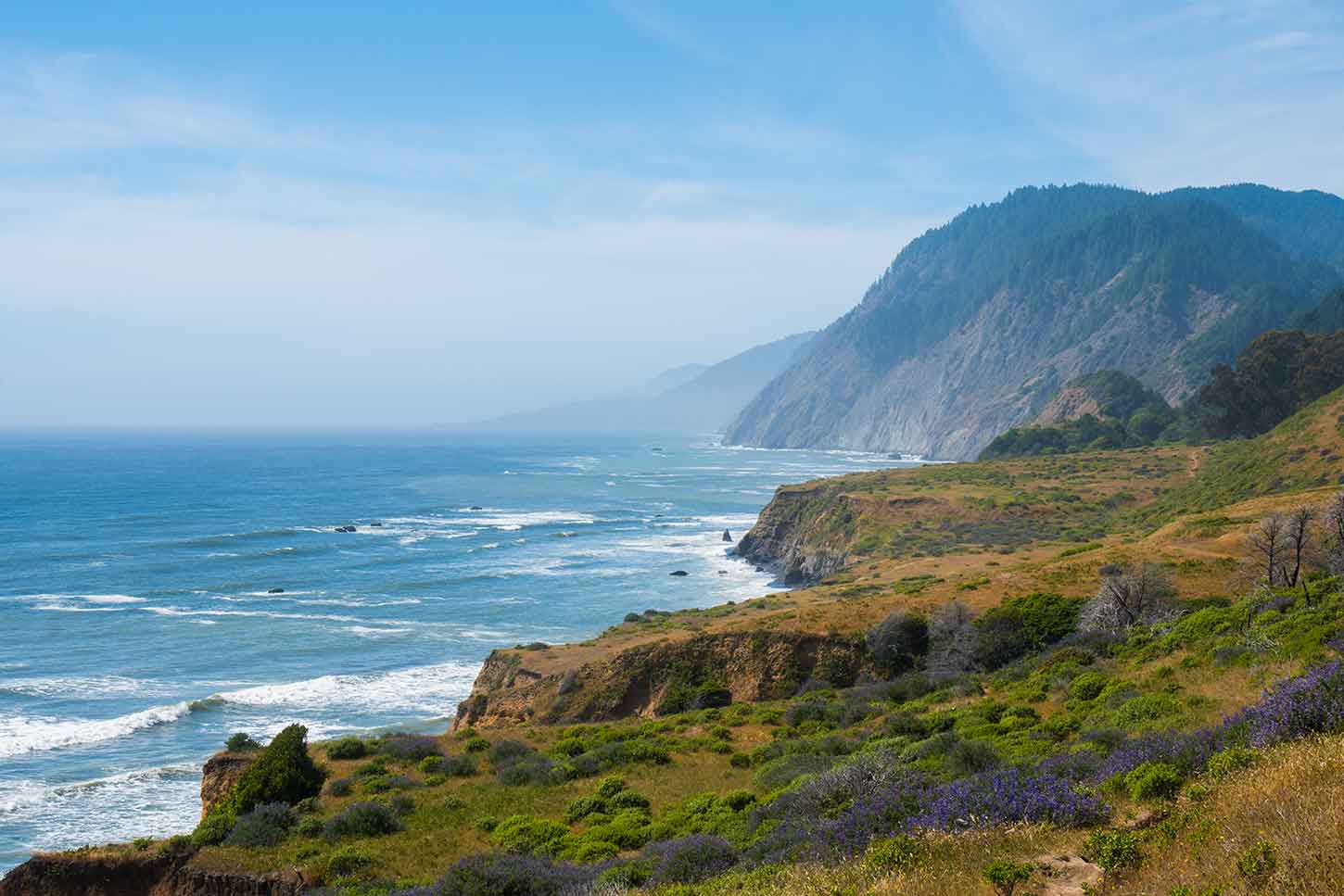
The Lost Coast earned its name because the terrain was too rugged to build a highway through it. Where Highway 1 turns inland, roughly 80 miles of Northern California shoreline continues without roads, cell towers, or development. It is one of the wildest stretches of coast left in the state, and it has stayed that way precisely because reaching it requires intention.
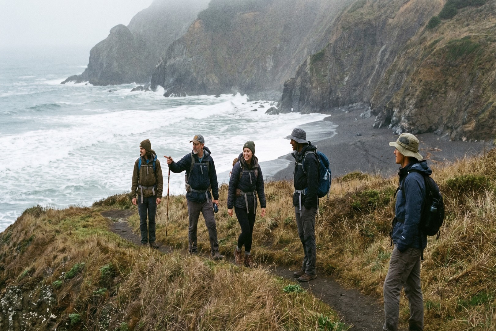
Most people assume this place demands a multi-day backpacking commitment, and that assumption keeps a lot of people away. The trails listed here are all day hikes, covering the full range of what this coastline and its interior forests offer: black sand beaches, old-growth canopy, open ridgelines, and remote coves where you can sit for an hour watching the surf. Bring layers, check the tide tables, and start early. The rest takes care of itself.

Distance: ~8 miles round trip
Difficulty: Moderate
Remote coastline • Historic lighthouse • Wildlife
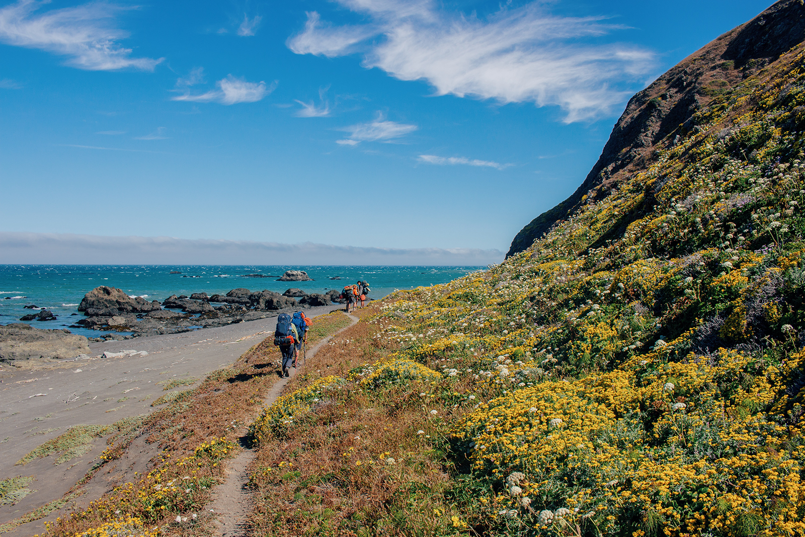
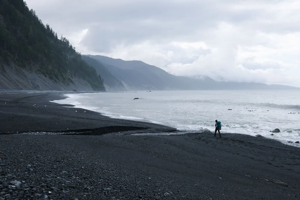
This is one of the most recognized sections of the Lost Coast Trail, and it earns the reputation. The route follows the shoreline south from Mattole Beach to the Punta Gorda Lighthouse, built in 1911 and long since decommissioned. The walk runs almost entirely on sand, and at lower tides the footing is firm and steady. Harbor seals rest on the rocks near the lighthouse, sometimes dozens of them, and they register your presence with almost complete indifference. The thing that stays with people is the scale of the emptiness: no buildings, no roads, no sound beyond surf and wind. This is what the coast looked like before anyone got ideas about improving it.

Distance: ~4 to 6 miles round trip
Difficulty: Moderate
Black sand beaches • Cliffs • Ocean views
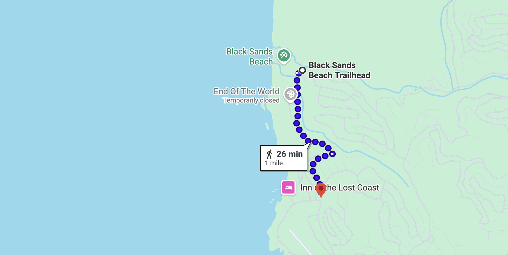
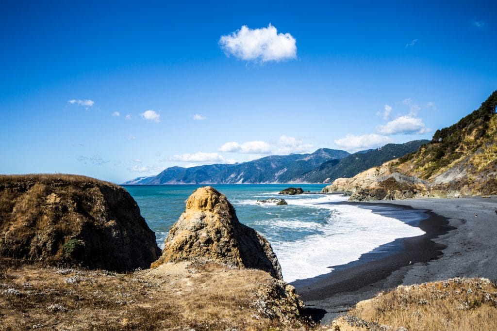
Shelter Cove is the only town on the Lost Coast with paved road access, and Black Sands Beach sits right at its edge. The sand here is volcanic and nearly black, and it stretches along the base of steep bluffs that rise sharply from the waterline. The walk can go in either direction; the distance depends on the tide and how far the terrain pulls you. This is the most direct way into the Lost Coast's signature landscape, and within ten minutes of leaving the parking area you are standing on sand that looks like it belongs somewhere in Iceland. For a first visit, this is the trail that sets the register for everything else.

Distance: ~8 miles round trip
Difficulty: Moderate to challenging
Coastal forest • Ocean views • Historic homestead sites
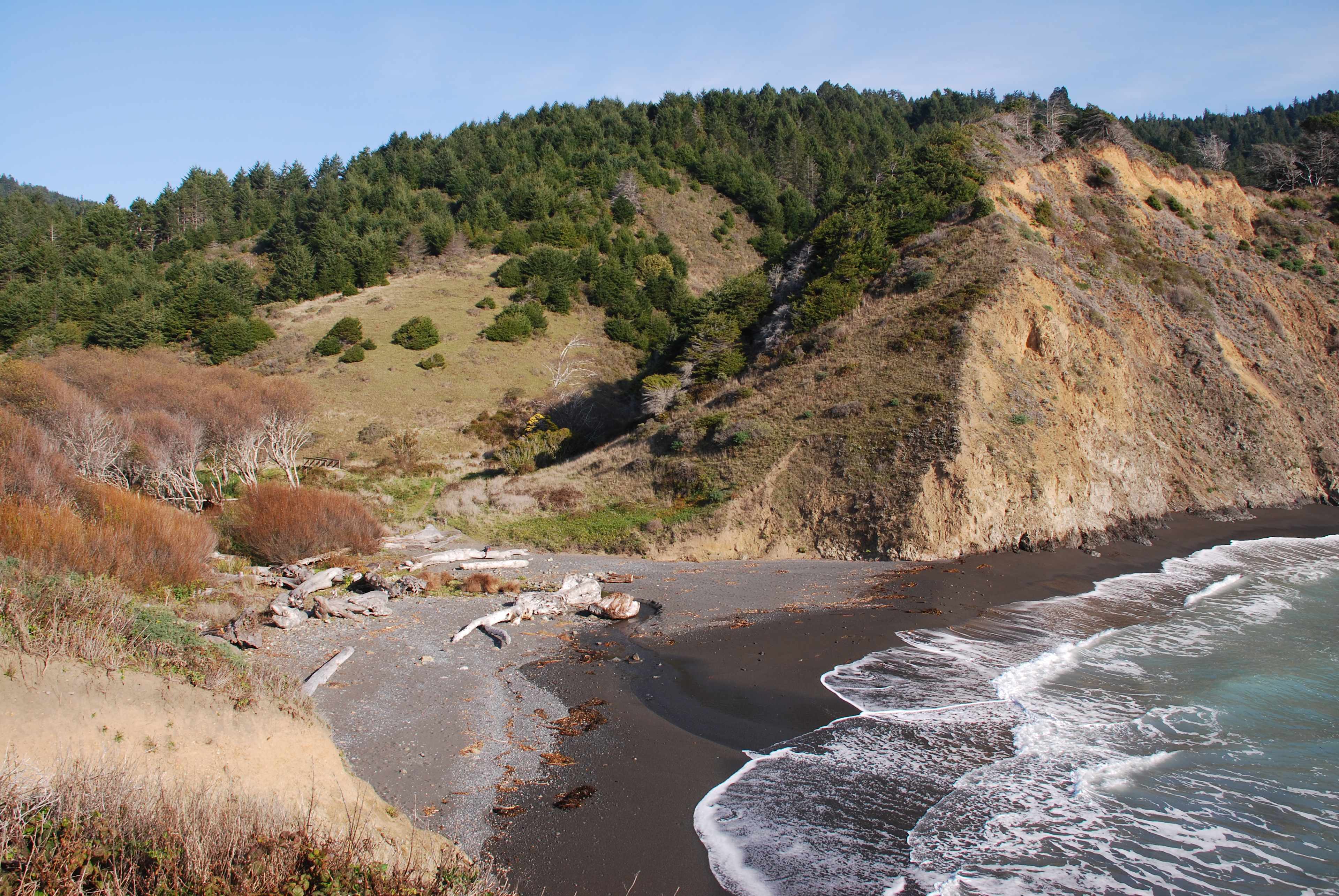
The Sinkyone Wilderness sits on the southern end of the Lost Coast and draws far fewer visitors than the trails further north. This route passes through redwood and Douglas-fir canopy, crosses seasonal creeks, and breaks onto open bluffs with views that extend miles along the shore in both directions. At Bear Harbor, old homestead clearings are slowly being reclaimed by grass and fern. What the place communicates, quietly and without drama, is that the land has its own timeline. Ours is a brief interruption of it.
Distance: ~3 to 5 miles (varies)
Difficulty: Easy to moderate
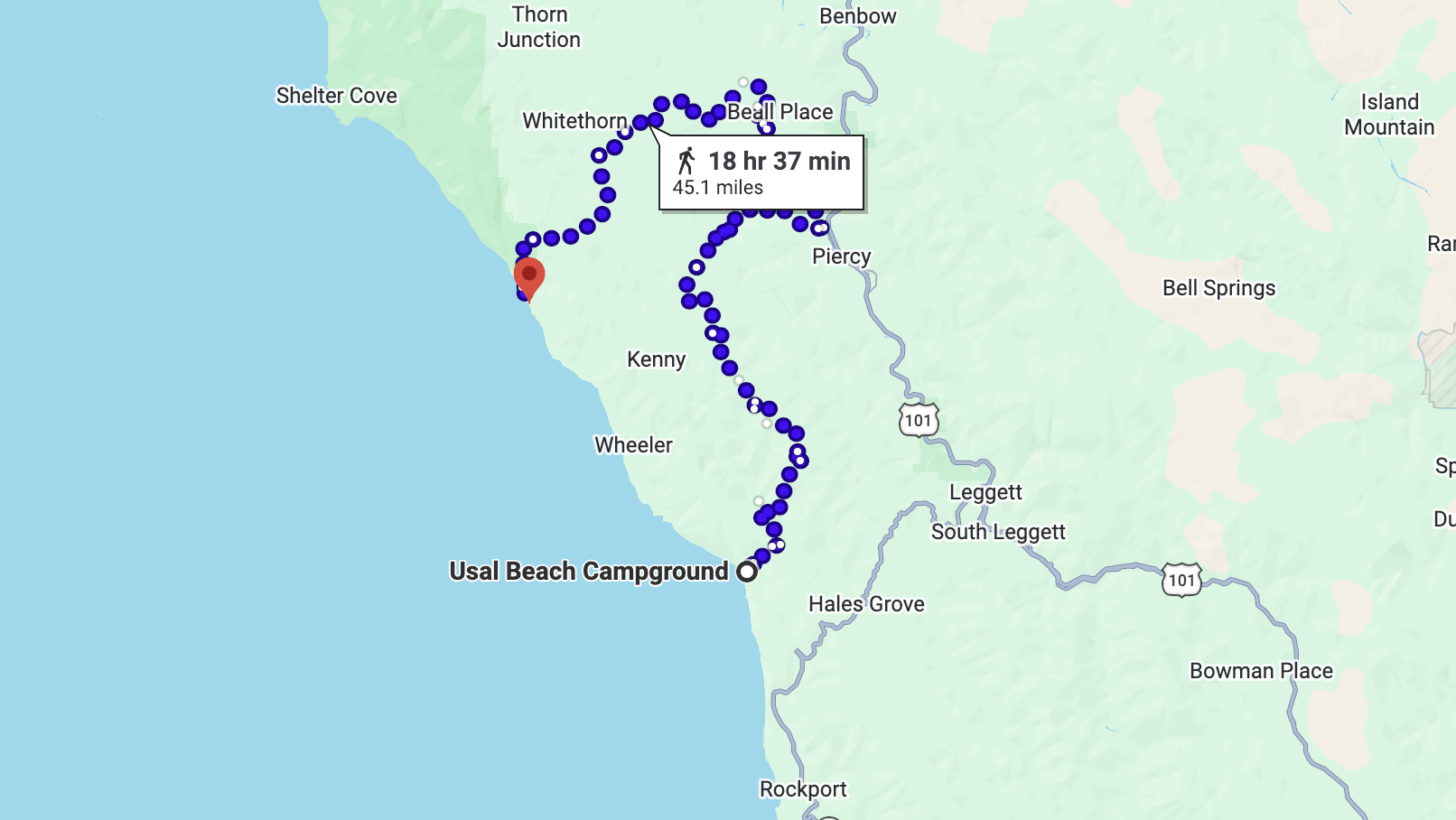
Remote beach access • Campsites • Scenic coastline
Usal Beach marks the southern boundary of the Lost Coast, adjacent to the 50,000-acre Usal Redwood Forest managed by the Redwood Forest Foundation. Getting there requires a long, winding drive down an unpaved road, and that friction is part of what keeps the beach as quiet as it is. The trail runs along bluffs above the water and through recovering forest, shifting between open ocean views and dense canopy within the same quarter mile. Visitors who book a guided ATV tour through Usal often add time on the beach to the day, since the two experiences read as one place from different vantage points.

Distance: ~3 miles round trip
Difficulty: Easy to moderate
Wildflowers • Forested canyon • Seasonal creek
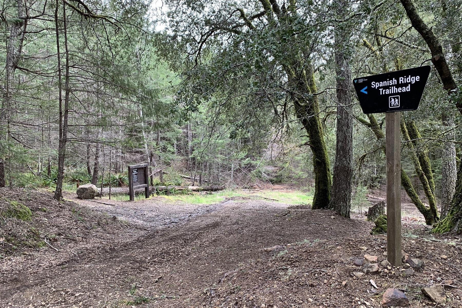
The King Range is the mountain wall that defines the Lost Coast, and Hidden Valley Trail is one of its quieter inland routes. The trail follows a shaded canyon alongside a seasonal creek, and in spring the lower sections fill with wildflowers. The mood here is entirely different from the coastal hikes: sheltered, green, enclosed. After a couple of days on exposed beach routes, this canyon offers a different register of the same wilderness. The shift in atmosphere is worth planning for on its own terms.


Distance: ~5 to 7 miles round trip
Difficulty: Moderate
Sweeping coastal views • Ridgeline hiking
Spanish Ridge runs along the top of the King Range, and on a clear day the views extend along the full curve of the shoreline. The terrain shifts from forest to open ridgeline as elevation builds, and the wind picks up noticeably at the top, so layers matter here even in summer. What this trail offers that ground-level routes cannot is perspective: from the ridge, the full scale of the Lost Coast becomes legible. The length of the beach, the depth of the forest, the way the mountains drop directly into the ocean with nothing in between.

Distance: ~2 to 4 miles
Difficulty: Easy
Clifftop views • Accessible trails • Ocean overlooks
The headlands sit just outside Shelter Cove, and the trails along the clifftops are short, well-maintained, and positioned for views that read as effortlessly earned. Easy enough for families, generous enough in what they show you. The light along this stretch of coast in late afternoon, when the fog is either rolling in or clearing, is something worth timing your arrival around. Plan for an hour and stay for two.

Distance: ~4 to 6 miles round trip
Difficulty: Moderate
Remote beaches • Quiet coastline • Wildlife
One of the least-traveled routes in the Sinkyone, and on most days you will have the trail and the beach to yourself. The access road to Bear Harbor is rough enough to discourage casual visitors, which is precisely what keeps Jones Beach as wild as it is. The hike passes through dense forest before dropping to a small, rocky stretch of shoreline backed by bluffs. For anyone who came here looking for genuine solitude with the land around them, this is the trail that consistently delivers it.
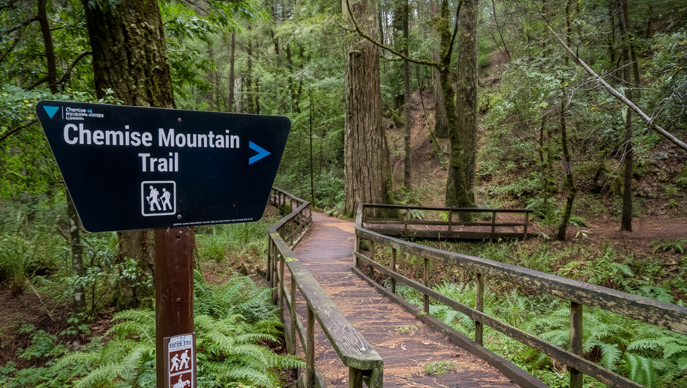
Distance: ~4 to 6 miles round trip
Difficulty: Moderate to challenging
Forest + coastal views • Elevation gain
Chemise Mountain sits in the King Range, and the trail gains enough elevation to earn views spanning both the coastline and the inland ridges. The lower sections pass through forest, and the upper terrain opens gradually as the tree line thins and the ocean becomes visible through breaks in the canopy. The reward here is cumulative: the landscape reveals itself in layers as you climb, and by the time you reach the top the view has been built slowly enough that its scale lands differently than it would from a viewpoint you simply drove to.
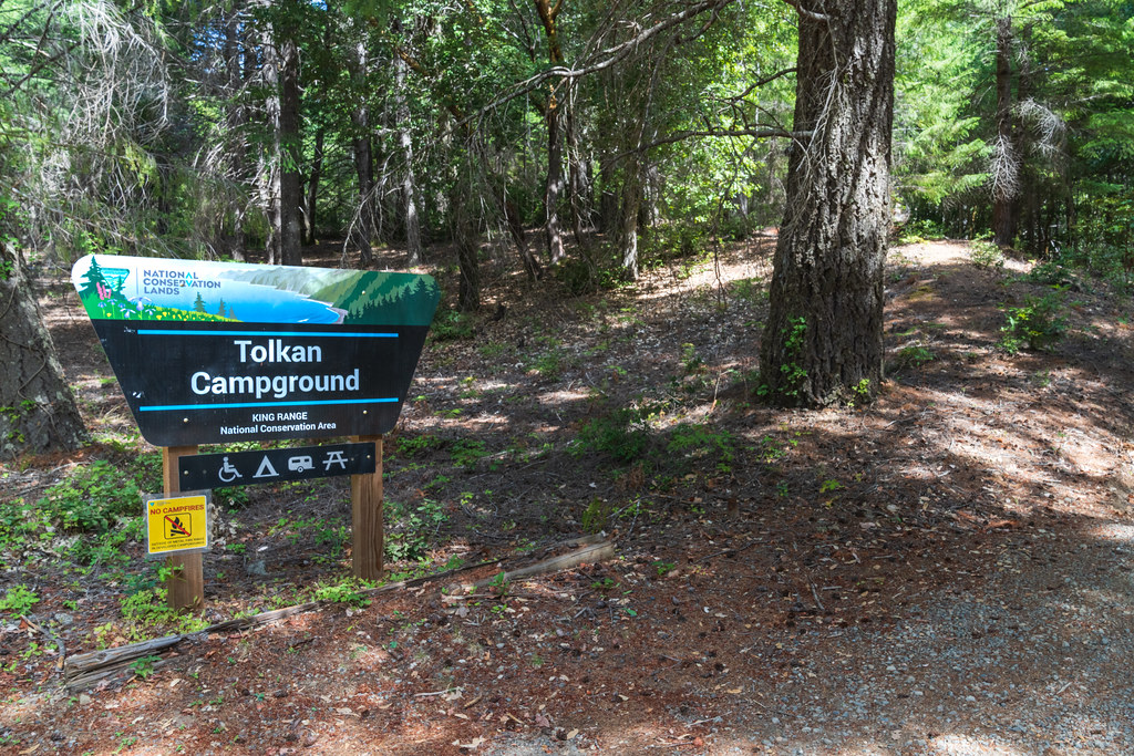
Distance:~2 to 4 miles
Difficulty:Easy to moderate
Redwoods • River access • Quieter inland setting
Tolkan sits inland near the South Fork of the Eel River, in a section of forest that feels quieter and more enclosed than anything along the shoreline. The trails move through redwoods tall enough to block most of the sky, and the river access gives the walk a second layer of texture. This is the trail for people who came to the Lost Coast region as much for the trees as for the ocean, and it makes the case that the interior of this landscape is as defining as its coast. The forest here is old enough that silence feels structural.
🌊 Check tide conditions before any beach hike. Certain sections of the Mattole and Black Sands routes become impassable at high water, and the tide tables will tell you more than the weather forecast will.
🥾 Wear sturdy shoes. The terrain ranges from loose volcanic sand to rocky bluffs to rooted forest trails, and none of it is paved or particularly forgiving of light footwear.
🌫️ Bring layers, even in summer. Fog and wind can change conditions significantly within an hour along this coast, and the ridgeline trails are exposed enough to feel a full season colder than the beach below.
📵 Plan on no cell service across every trail listed here. Start early to get the best light, the calmest wind, and the most time before the tide shifts. Maps and water go in the pack before anything else.
The Lost Coast stays wild because people chose to protect it. The Redwood Forest Foundation manages 50,000 acres of old-growth redwood forest along this coastline, working to restore what was lost and keep these trails open for the next generation. If this place meant something to you, support the work that keeps it this way.